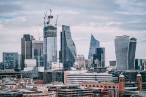
The census says the population has risen by 15.60% since 2001 and has reached a total figure of 61,095,297. The state has an area of 191,791 sq km, and the population density is 319 per sq km. The population growth rate was highest in Bengaluru, the state capital, that increased by 47.18 per cent, while Chikmagalur was the only district which showed a very minor decline of 0.26 percent. Karnataka contains 31 districts that are ranked from highest to lowest on the basis of population.
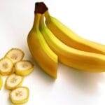
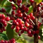
Well, the huge growth now in Bangalore can be attributed to the fact that it has evolved as an IT hub where professionals from the country and abroad are getting attracted. Moreover, it is also famous for its tech parks, storied educational institutions, and lively startup ecosystem. On the other hand, Chikmagalur is basically a district famous for coffee plantations and serene landscapes. Vijayanagara is new district which was created in 2021 from the Bellary district.
| # | District | Population | Increase | Density |
|---|---|---|---|---|
| 1 | Bangalore | 96,21,551 | 47.18% | 4381 |
| 2 | Belgaum | 47,79,661 | 13.41% | 356 |
| 3 | Mysore | 30,01,127 | 13.63% | 476 |
| 4 | Tumkur | 26,78,980 | 3.65% | 253 |
| 5 | Gulbarga | 25,66,326 | 18.01% | 234 |
| 6 | Bellary | 24,52,595 | 20.99% | 290 |
| 7 | Bijapur | 21,77,331 | 20.50% | 207 |
| 8 | Dakshina Kannada | 20,89,649 | 10.11% | 430 |
| 9 | Davanagere | 19,45,497 | 8.63% | 328 |
| 10 | Raichur | 19,28,812 | 15.51% | 228 |
| 11 | Bagalkot | 18,89,752 | 14.40% | 288 |
| 12 | Dharwad | 18,47,023 | 15.13% | 434 |
| 13 | Mandya | 18,05,769 | 2.38% | 364 |
| 14 | Hassan | 17,76,421 | 3.18% | 261 |
| 15 | Shimoga | 17,52,753 | 6.71% | 207 |
| 16 | Bidar | 17,03,300 | 13.37% | 313 |
| 17 | Chitradurga | 16,59,456 | 9.33% | 197 |
| 18 | Haveri | 15,97,668 | 11.02% | 331 |
| 19 | Kolar | 15,36,401 | 10.77% | 386 |
| 20 | Uttara Kannada | 14,37,169 | 6.17% | 140 |
| 21 | Koppal | 13,89,920 | 16.21% | 250 |
| 22 | Chikkaballapura | 12,55,104 | 9.23% | 296 |
| 23 | Udupi | 11,77,361 | 5.85% | 329 |
| 24 | Yadgir | 11,74,271 | 22.81% | 223 |
| 25 | Chikmagalur | 11,37,961 | -0.26% | 158 |
| 26 | Ramanagara | 10,82,636 | 5.05% | 308 |
| 27 | Gadag | 10,64,570 | 9.54% | 229 |
| 28 | Chamarajanagar | 10,20,791 | 5.73% | 181 |
| 29 | Bangalore Rural | 9,90,923 | 16.45% | 431 |
| 30 | Vijayanagara | 1,353,628 | - | 320 |
| 31 | Kodagu | 5,54,519 | 1.09% | 135 |